SAR for Smart Agricultural Insurance Assessment

Satellite Synthetic Aperture Radar for Smart Agricultural Insurance
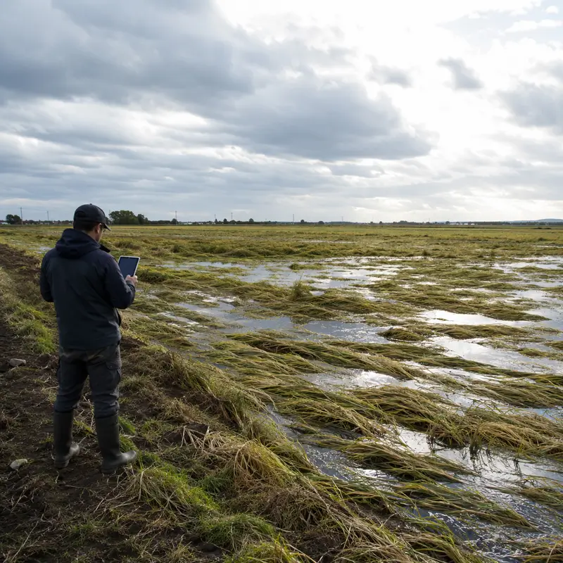
When a storm passes over a farm, damage does not always appear as a field that has been completely destroyed. Sometimes the stems bend, the heads fall to the ground, water remains in parts of the field, and a portion of the crop still looks healthy from a distance. For the farmer, these subtle differences can mark the line between an acceptable harvest and a heavy loss. For the insurer, the issue is not only seeing the damage, but also proving the timing, extent, and severity of that damage in a defensible and repeatable way.
This is precisely where satellite synthetic aperture radar, or SAR, becomes important, because unlike optical sensors, it does not depend on daylight and can observe the Earth’s surface under many cloudy conditions. This feature has operational importance for losses such as flooding, storms, wind damage, crop lodging, and hail, because the time window after an event is short, and optical imagery may be unusable because of clouds, rainfall, or an unsuitable satellite overpass time. Sentinel-1, within European programs, is one of the well-known examples of this logic, and its use in cloudy tropical and subtropical regions has also been emphasized. The value of such data increases when its output is connected to the insurance system, farm boundaries, and ground data.
The importance of this issue for food security and the agricultural economy is not merely technical. In a country where grains and rice account for a significant part of the food basket, a tool for rapid damage assessment can affect farmer confidence, insurance sustainability, public resource allocation, and investor decisions. FAO GIEWS estimated Iran’s cereal production in 2024 at 22.4 million tons and reported Iran’s rice production in 2025 at about 3.8 million tons, close to the average level. This scale shows that damage assessment for staple crops is not only an administrative issue in insurance; it is connected to the resilience of the food chain and national risk management.
Why Does Synthetic Aperture Radar Matter for Rapid Crop Damage Assessment?
SAR is an active microwave sensor, meaning the satellite sends out its own radar pulse and measures the energy returned from the land surface and vegetation cover. In agriculture, radar backscatter is influenced by canopy structure, surface roughness, soil moisture, waterlogging, viewing angle, and polarization. This sensitivity makes it possible to track sudden changes in a field, such as bent stems or waterlogging after heavy rainfall, through radar time series. However, this observation alone does not amount to a definitive judgment and must be interpreted together with farm boundaries, the event date, the crop growth stage, and ground data.
In optical remote sensing, greenness and indices such as NDVI play a prominent role, but storm and flood damage often occur when the sky is covered with clouds or lighting conditions are not suitable for reliable imagery. Radar provides an independent layer of evidence in this situation and can reduce the time gap between the event and field assessment. This advantage matters for agricultural insurance, because delays in identifying damage usually increase claims-handling costs, farmer dissatisfaction, and disputes over the file. Radar becomes more valuable when it is not used merely as a raw image, but is converted into an index, a damage map, and part of the insurer’s decision-making process.
– Malay Kumar Poddar, Chairman and Managing Director of the Agriculture Insurance Company of India: “Damage assessment based on remote sensing technology brings greater objectivity into the crop insurance program.”
Objectivity in agricultural insurance means keeping the damage output as far as possible from the individual judgment of the assessor, time pressure, and competing narratives. In this process, SAR acts as a spatial and temporal witness, but being a witness is different from issuing a final verdict. A radar image can show where change has occurred, how severe the change is compared with the previous condition, and whether the pattern of change is consistent with waterlogging, lodging, or partial canopy loss. A valid insurance decision emerges when this evidence is combined with ground protocols, the insurance contract, and predefined criteria.
How Do Crop Lodging and Storm Damage Appear in Radar Signals?
Crop lodging refers to the bending or falling of stems and heads as a result of wind, rain, high planting density, stem weakness, disease, or the weight of the head. From a SAR perspective, this event is not merely a visual change in the field; it is a change in canopy geometry and in the way radar waves are reflected. When the upright structure of the plant turns into a flattened or irregular structure, the co-polarized and cross-polarized responses may change, and ratios such as VV/VH become important for detecting the event. In crops such as wheat and rice, this sensitivity must be interpreted alongside growth stage and soil moisture, because a similar signal may result from several different physical causes.
Wind and storm damage also often appear in radar data as sudden structural changes in vegetation cover, stem breakage, lodging, partial canopy removal, moisture changes, and sometimes waterlogging after heavy rainfall. This multi-factor combination means that a damage model should not rely on a single image and instead requires a before-and-after comparison of the event. If a Sentinel-1 time series is available, changes in backscatter before and after the storm can provide important clues about the location and severity of the damage. However, to turn a clue into an insurance output, accurate farm segmentation and field sampling still play a foundational role.
– Backscatter and Polarization in Detecting Canopy Structure Change
Radar backscatter is usually reported in decibels and depends on what surface the radar wave interacts with and how it returns to the sensor. In a healthy field, the vertical structure of the plants, the moisture of leaves and stems, the soil surface, and the spacing between rows create a specific pattern. With crop lodging, part of this geometry changes, and the responses of VV and VH polarizations may also follow different paths. This difference makes it possible to design radar indices for damage detection, but their accuracy remains dependent on local calibration and knowledge of the crop variety.
In agricultural flooding, the issue becomes more complex, because open water often has low backscatter in radar imagery and appears dark, but a waterlogged field does not always look like an open water surface. Standing vegetation in water, rough soil, urban texture, forests, and even the satellite viewing angle can make interpretation difficult. In its study of flooding in Chad, the World Bank emphasized the power of radar and microwave data for fine-scale flood monitoring, while also warning against excessive certainty at very precise times and locations. This warning is critical for agricultural insurance, because paying claims based on a map that has not been sufficiently audited can create new disputes.
– World Bank Group, authors of the analytical document on Chad flood monitoring: “Remote sensing, especially satellite imagery, radar, and microwave data, has made fine-grained temporal and spatial flood detection possible.”
Parametric Agricultural Insurance and the Role of SAR in Trigger Verification
In parametric insurance, a claim payment is activated when an index crosses a predefined threshold, not necessarily after a full inspection of every single field. This index must be measurable, independent of the insured party’s behavior, repeatable, and sufficiently correlated with actual damage. Earth observation data, including SAR, can be used for risk assessment and trigger verification, provided that the event definition and calculation method are clarified before the loss occurs. In events such as flooding, storms, and lodging, this predefined structure can shorten the distance between the incident and the insurance decision.
The growth of parametric insurance shows that the insurance market needs fast, auditable, and scalable data. EUSPA has reported that parametric insurance is growing at up to 11 percent annually, with one of its drivers being the increasing availability and accuracy of Earth observation data for risk assessment and trigger verification. This trend is especially important for agriculture, because climate-related farm losses are usually widespread, heterogeneous, and time-sensitive. SAR can be part of this data infrastructure, but it cannot by itself replace insurance design, ground data, or an appeals mechanism.
– European Union Agency for the Space Programme, the official space agency of the European Union: “Parametric insurance is growing rapidly, with growth rates reported at up to 11 percent per year.”
– Basis Risk and the Boundary Between a Satellite Index and Actual Damage
The main limitation of index-based insurance is basis risk, meaning the difference between the farmer’s actual loss and the loss estimated by the index. The NHESS review explains this risk through three sources: design, spatial, and temporal. In SAR, the spatial source may come from inaccurate farm boundaries or within-field heterogeneity; the temporal source may arise from the gap between the event and the satellite overpass; and the design source may be related to choosing the wrong index or threshold. Therefore, no matter how accurate radar data becomes, the issue of contract design and error control remains.
– Christina Fyles and Nitin Nambiar, Global Index Insurance Facility at the World Bank Group: “Misinterpreting any environmental variable in large-scale index insurance can severely affect the livelihoods of many farmers.”
This warning means that SAR should be viewed in agricultural insurance not as a black box, but as part of a decision chain. The damage map must include metadata, image date, sensor type, model version, processing method, confidence level, and the possibility of review. If the farmer or insurer cannot understand how the algorithmic output was produced, the traditional dispute over field inspection may turn into an algorithmic dispute. To reduce this risk, radar indices must be accompanied by ground data, sampling, and clear appeal rules.
How Did Tamil Nadu and RIICE Connect SAR to Rice Insurance Payments?
The case of Tamil Nadu in India is one of the clearest examples of linking Sentinel-1, the RIICE program, and agricultural insurance payments. In this experience, the Government of Tamil Nadu, the Agriculture Insurance Company of India, Tamil Nadu Agricultural University, the International Rice Research Institute, sarmap, Swiss Re, and the RIICE program came together. ESA reported that Tamil Nadu had a population of about 68 million and nearly 1 million rice farmers, and that more than 200,000 farmers benefited from payments linked to Sentinel-1 and RIICE assessments. The RIICE/GIZ report also mentions payments to 203,000 smallholder farmers affected by drought under India’s national crop insurance program.
The value of this example lies not only in the payment figure, but also in its institutional architecture. The RIICE program was implemented with support from Swiss and German donors and was used within a national crop insurance program worth $2.8 billion. This means that satellite data became an operational tool when the university, government, insurer, technology company, and financial backers took on complementary roles. For agriculture, this model shows that SAR does not become a reliable insurance product without data governance, analytical capacity, and a connection to the payment process.
– Gagandeep Singh Bedi, Agricultural Production Commissioner and Principal Secretary to the Government of Tamil Nadu: “RIICE remote sensing technology enables crop damage assessment to be carried out more transparently and in a more timely manner.”
Within the same program, RIICE/GIZ reported an accuracy of about 90 percent for outputs from Tamil Nadu Agricultural University in delivering seasonal damage information and end-of-season yield estimates, compared with official data or the university’s own measurements. This figure should be read with caution, because it was presented as a program report, and its validity for each individual farm must be understood within that program’s context. Even so, it is important for understanding the implementation pathway, because it shows that the operational credibility of SAR in insurance is built through a combination of satellite data, a scientific institution, and an insurer. The key lesson for policymakers is that a successful pilot is not merely the product of an algorithm; it also requires a scientific intermediary institution.
The Position of SAR in Satellite-Based Index Insurance and Complementary Data
A 2025 systematic review in NHESS, based on 89 global studies, shows that satellite data-based index insurance has reached a stage where it is no longer a marginal idea. In this review, 91 percent of studies using satellite data relied on land surface observation data, and NDVI was the dominant index in 61.2 percent of satellite imagery-based studies. These figures carry an important message: in agricultural insurance, optical data still dominates, and SAR should be understood as a powerful complement under cloudy, flood-prone, and rapid-event conditions. Therefore, the claim that SAR can completely replace all existing indices is not consistent with the evidence.
– Tung Nguyen Huy and colleagues, researchers of the NHESS article on satellite data and agricultural index-based insurance: “This review analyzed 89 global studies across four major crop groups.”
In practice, strong insurance systems usually do not remain limited to a single data source. Sentinel-1 can provide the radar dimension, which is more resilient to clouds, while Sentinel-2 can complement it with multispectral information and vegetation indices. As an industrial trend, ESA Space Solutions’ EO-INSURE project has also introduced the combination of Sentinel-1 SAR, Sentinel-2 optical data, weather data, and field data for detecting abiotic damage in orchards. This example is not a scientific performance assessment, but it shows that the insurance services market is moving toward multi-source architectures.
In such an architecture, radar data is used to detect structural change, optical data to assess the biological condition of vegetation cover, weather data to provide event context, and ground data for calibration. If the goal is only to produce a map, combining data may seem complex; but if the goal is claim payment, this same complexity improves defensibility. The insurer must be able to explain why one parcel qualified for payment and another did not. That explanation will not be reliable without recorded metadata, farm boundaries, and the model version.
Spatial Data Governance for the Insurance Acceptance of SAR Damage Maps
A damage map has value for insurance only when it is not merely a colored image of a farm and when its production path can be traced. The ISO 19115 standard is used for recording metadata for geographic information, including identification, extent, quality, spatial reference, temporal reference, and spatial data distribution. In SAR-based insurance, this metadata can explain when the image was captured, which area it covered, what processing was applied to it, and what level of quality the output has. Without this layer, the damage map remains technically fragile in a dispute between farmer and insurer.
OGC standards are also important for the interoperability of spatial systems, because the damage layer, farm boundary, and model results must be transferred among the insurer, government, assessor, and sometimes a scientific institution. Services such as WMS, WFS, WCS, and OGC API can serve as the common language of this exchange and prevent damage maps from turning into scattered, non-auditable files. At the data governance level, INSPIRE in the European Union is an example of a spatial data infrastructure framework that covers 34 spatial data themes for environmental policies and activities with environmental impacts. For agricultural insurance, the message of such frameworks is clear: spatial data must be institutionalized, standardized, and connected to the decision-making process.
In its Chad flood document, the World Bank emphasizes that satellite resources are highly useful for identifying and monitoring potential flood areas at an aggregated level, but should not be treated as definitive criteria at very specific times and locations. This statement matters for insurance regulation, because a SAR map must be accepted alongside other evidence, and its level of certainty must be clearly defined in the contract or guideline. If satellite output is used as a tool for screening, prioritizing field visits, and verifying triggers, both its operational value is preserved and the risk of making a final decision based on a single observation is reduced. This approach is more compatible with the nature of agricultural insurance, which always moves between technical accuracy and payment fairness.
The Path to Localizing SAR for Staple Crop Insurance in Iran
In Iran, Article 33 of the Seventh Five-Year Development Plan requires the Agricultural Insurance Fund, through insurance company agencies, to provide compulsory all-risk insurance for staple crops, including wheat, barley, rice, legumes, sugar, corn, and oilseeds, against natural hazards and accidents. This mandate creates institutional demand for rapid, nationwide, and auditable damage assessment. Within this framework, SAR can be considered one of the data layers for monitoring widespread and rapid events, especially for crops damaged during rainy seasons, in cloudy regions, or under flood conditions. However, this pathway must be designed based on a clear distinction between general remote sensing and SAR data.
The opportunity for localization in Iran begins with connecting remote sensing to broad-based insurance for staple crops, not with the claim that an operational system is already ready. For wheat and rice, the combination of farm boundaries, planting and harvest dates, meteorological data, field sampling, and Sentinel-1 time series can form the basis of a defensible pilot. The goal of such a pilot should be to assess SAR’s capacity to detect events such as lodging, flooding, and sudden canopy structure change, not to issue definitive payment decisions without field control. If the pilot is designed from the outset with an index, threshold, confidence level, and appeals mechanism, its transferability to compulsory staple crop insurance will increase.
At the operational level, Iran needs a data architecture that connects insured parcels to satellite pixels, ground data, and damage files. Without this connection, spatial basis risk increases, because one farmer’s damage may be lost in the average of a large area, or conversely, regional damage may be attributed to a parcel that has suffered less actual loss. For rice- and wheat-growing regions, distinguishing the crop growth stage is also important, because the radar signal does not carry the same meaning at every stage of growth. Successful localization must establish a balance from the beginning among scientific accuracy, implementation cost, insurer capacity, and farmers’ understanding of the output.
– A Blended Investment Model to Reduce Early Implementation Risk
The RIICE experience shows that implementing SAR in agricultural insurance can take shape through a public-private partnership model and blended financing. In such a model, the government provides institutional demand and the insurance framework, the insurer controls the claims and payment process, a university or scientific institution supports calibration and validation, and a technology company develops the processing infrastructure and dashboard. Development assistance or risk capital can also reduce the risk of the pilot phase, just as RIICE advanced with Swiss and German support alongside Indian institutions. For Iran, a similar logic is defensible only when the pilot output is connected to Article 33, staple crops, and the real needs of the Agricultural Insurance Fund.
The investment pathway should not begin with general figures about setup costs or definite savings. A more accurate starting point is to define the implementation package: farm boundaries, the Sentinel-1 archive, complementary Sentinel-2 data, meteorological data, ground samples, a processing engine, a metadata system, an insurer dashboard, and an appeals protocol. This package should be tested on one crop, in one province, or within one limited agricultural zone, and its success criteria should be determined before implementation. The appropriate criterion is not only algorithmic accuracy; it should also include map production time, explainability of the output, consistency with field data, and insurer acceptance.
A Practical Summary for Linking SAR to Agricultural Insurance in Iran
Satellite synthetic aperture radar is not a simple imaging tool for agricultural insurance and should not be presented as a complete substitute for field visits, ground data, or insurance design. Its main value lies in providing spatial and temporal evidence for events that occur rapidly, remain hidden under cloudy conditions, or make field assessment difficult at large scales. Crop lodging, storm damage, and agricultural flooding fall exactly into this category, because their changes are tied both to the time of the event and to the physical structure of the farm. Proper use of SAR means converting radar imagery into an auditable index, not turning an algorithm into an unquestioned authority for claim payment.
For Iran, the logical path runs through a limited, transparent, and multi-institutional pilot. This pilot should focus on a crop such as wheat or rice, have a clear relationship with Article 33 of the Seventh Development Plan, and include farm boundaries, ground samples, metadata, data exchange standards, and an appeals mechanism from the outset. The Tamil Nadu experience shows that connecting government, insurer, university, technology company, and financial backer can bring satellite data closer to insurance payment. For this pathway to become reliable in Iran, SAR must be translated into the language of insurance governance; that is, every damage pixel must be connected to a parcel, policy, event, index, confidence level, and possibility of review.
The practical result is that SAR can become one of the pillars of data-driven agricultural insurance, but only alongside complementary data and a clear institutional framework. At the national scale, success is not limited to algorithm quality; it depends on spatial standards, legal acceptance, processing capacity, assessor training, and farmer trust. If these components are addressed together, synthetic aperture radar can move from being an advanced space technology to a risk-reduction tool in the food chain. For staple crop insurance, such a shift is less a technology project than a project of data governance and economic trust.